When and where are we surveying?
When did we do it?
The airborne survey took place between August and November 2013.
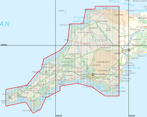
Where did we do it?
The majority of the south west region covering most of Cornwall, Devon and part of Somerset was surveyed. The survey started in the west (2 km west of Land’s End) and progressed eastwards towards Exeter.
The survey plane typically flew at 80 m altitude over rural areas and higher than 240 m over urban areas. Flights followed a systematic 'back and forth' pattern of linear north–south transects across the region with a flight line spacing of 200 m.
Survey progress was monitored by a weekly updated flight plan.
Who are we and who has paid for the work?
The project will be delivered by a partnership of NERC research centres, the British Geological Survey, the British Antarctic Survey and the Centre for Ecology and Hydrology, working in partnership with government, regulators, industry and universities based in the region.
The airborne geophysical contractor is Fugro Airborne Surveys (Pty) Ltd.
Further questions?
For further information please see the Tellus South West FAQs